eVidens® is a tool that uses geographic visualization to generate added value in the data of different systems, building an information that provides a more complete and analytical territorial reality.
Its architecture of connectors enable the visualization of information from various data sources and non-standard services.
Its users can create new custom Viewers for different uses and applications.
Organization of information and custom visibility settings as well as edition of Viewers and Resources.
Appealing to public presentations and diffusion of complex information with it presentation interface and custom Scenes and Routes.
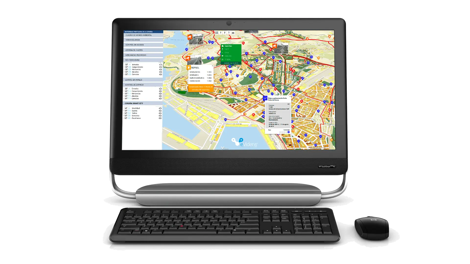
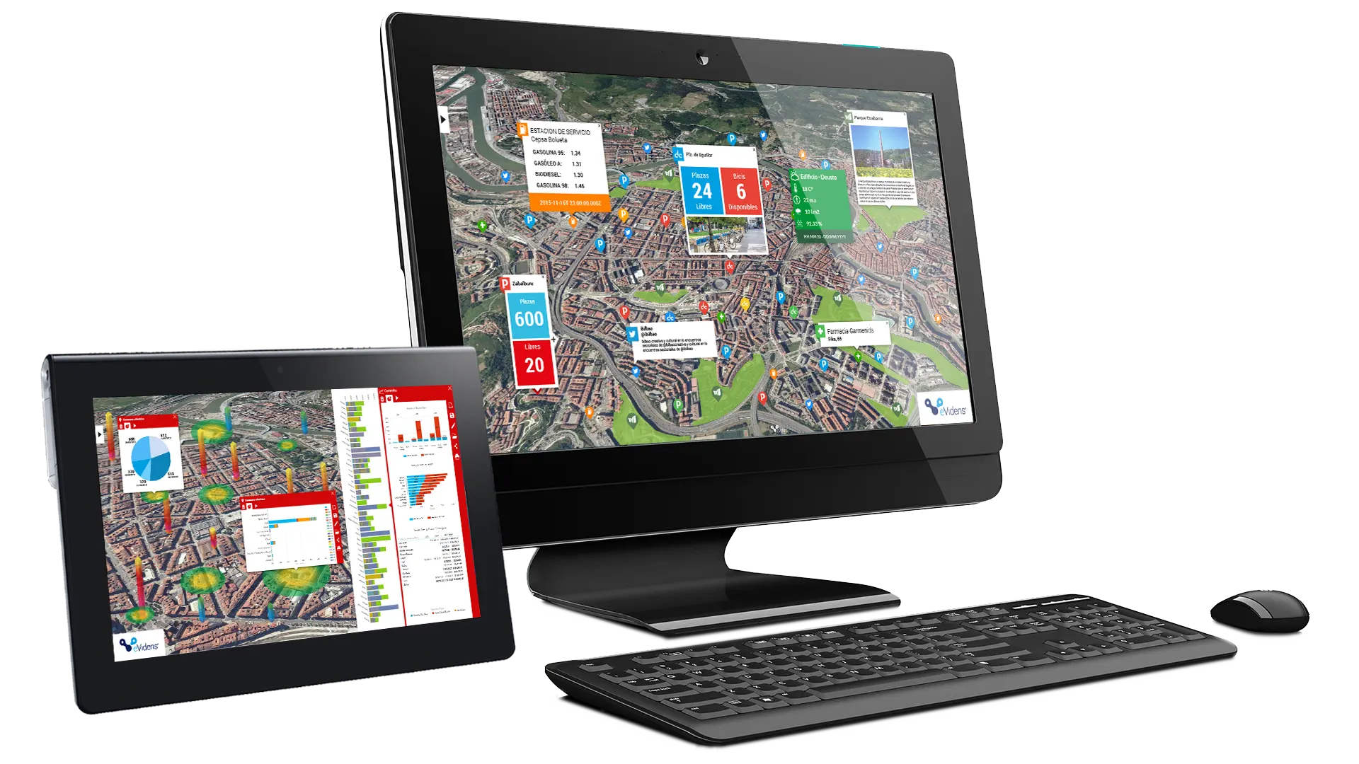
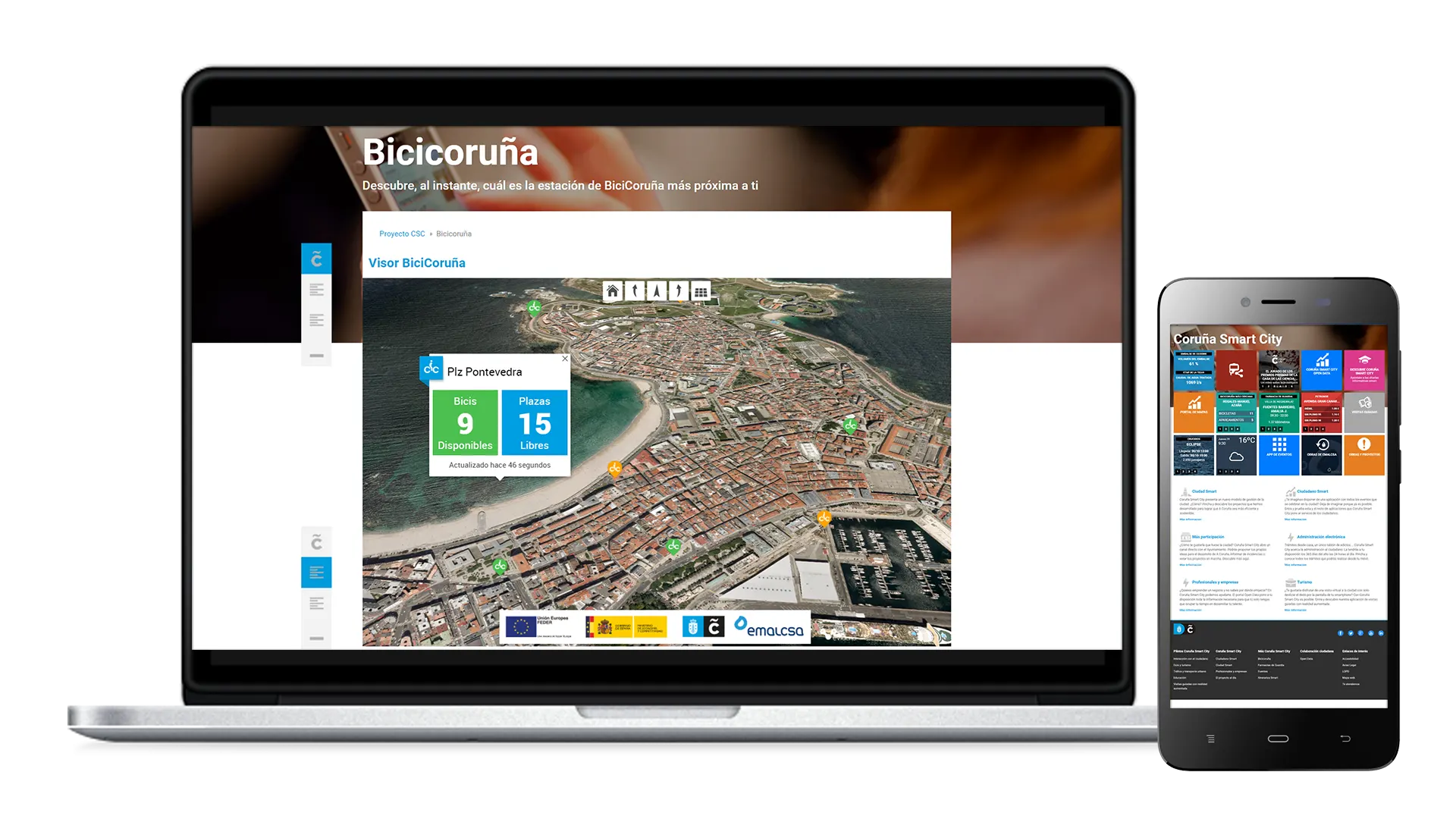
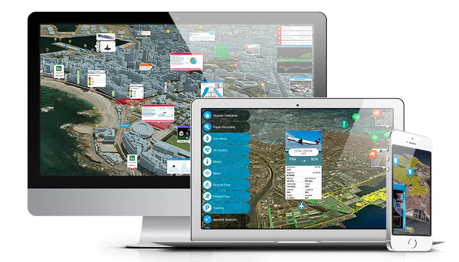
eVidens® provides the capacity to build custom dashboards and real-time data viewers with the geographical component as added value.
Dashboards that users generate with eVidens®, connect to IoT platforms, Big Data, Business Intelligence, GIS, monitoring systems…
eVidens® has a decoupled architecture which enables an easy integration with other service platforms though dynamic and modular developments, becoming a product that adds value to projects seeking comprehensive management.
The information comes to the user directly and easily. eVidens® provides the ability to analyse a complete scenario instead a non-specific and isolated data, with the possibility of accessing to detailed information and other any data or indicator.
High degree of integration with other critical business applications, geographic information systems, M2M platforms, monitoring systems, Business Intelligence, SCADAS… Simultaneous access to great volume of information (Big Data), preprocessed (BI) and real-time information (IoT).
eVidens® architecture is completely modular. This modularity allows the definition and development of new software pieces providing access to new data or new information adequately represented.
Any item or data can be analysed, displayed and represented. eVidens supports and combines different types of information either textual, multimedia or sensors… and shows it in an integrated and appropriate way for each use and user.
Native application for desktop client based on OpenGL, and web client, based on WebGL, which enables integration into mobile devices.
eVidens® supports standard OGC services and native ESRI services, displaying raster and vector GIS information.
Simultaneous queries to different services allows to show unified results that integrate information from multiple platforms.
eVidens® integrates access and connection to secured services provided by different platforms that integrates.
Possibility of integration of HTML content in Desktop and Web clients to facilitate the extension of the product.
Efficient management of Resources including dynamic load of geographic information depending on the point of view of user.
Capacity to adapt to the physical environment and the context of the user who starts a Viewer modulating 2D/ 3D representation.
Different visual styles on the information applying filters depending on different parameters or complex operations between them.
Grouping collections of elements over the territory according to of similarity and short distance criteria.
User permission management that allows customized visibility configurations and management of groups of Viewers and Resources.
Three-dimensional models, animations, effects and complex representation over the territory.
Possibility of multi-language interfaces, windows, dialog boxes and own eVidens® tools.
It is easy to use and easy to handle, even for users with low level of expertise, and has a solid basis for creating custom tools that streamline and facilitate the management of data from different platforms that are integrated into their dashboards.